ATTENTION: The works hosted here are being migrated to a new repository that will consolidate resources, improve discoverability, and better show UTA's research impact on the global community. We will update authors as the migration progresses. Please see MavMatrix for more information.
Show simple item record
| dc.contributor.author | Goodwin, Katherine R. | |
| dc.date.accessioned | 2016-06-10T01:01:07Z | |
| dc.date.available | 2016-06-10T01:01:07Z | |
| dc.date.issued | 2002 | |
| dc.identifier.uri | http://hdl.handle.net/10106/25712 | |
| dc.description | October 4, 2002 - January 15, 2003 | en_US |
| dc.description.sponsorship | Center for Greater Southwestern Studies and the History of Cartography, UTA * Philip Lee Phillips Society * Special Collections, UTA Libraries * Texas Map Society; Virginia Garrett Cartographic History Library Endowment | en_US |
| dc.description.tableofcontents | Introduction (4) - Exploration and Discovery (7) - Trade and Mercantile Interest (13) - Imperial Aims and Scientific Accuracy (19) - Sea Power and Political Influence (25) -- Commercial Enterprises and Coastal Surveys (31) - Spanish Contributions to New World Cartography (37) - The Greater View (43) - Selected Research Bibliography (46) | en_US |
| dc.language.iso | en_US | en_US |
| dc.publisher | Special Collections, Central Library, The University of Texas at Arlington Library | en_US |
| dc.rights | ©2002 | |
| dc.subject | Cartography | en_US |
| dc.subject | Mapmaking | en_US |
| dc.subject | New World -- Exploration -- Maps | en_US |
| dc.subject | Gulf of Mexico region --Maps | en_US |
| dc.subject | Caribbean Islands -- Maps | en_US |
| dc.subject | Maps -- Historical intereptation | en_US |
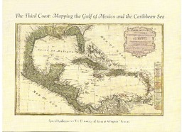
| dc.title | The Third Coast: Mapping the Gulf of Mexico and the Caribbean Sea | en_US |
| dc.type | Gallery Guide | en_US |
| dc.description.pagination | 48 pgs. | en_US |
Files in this item
- Name:
- The Third Coast.pdf
- Size:
- 65.46Mb
- Format:
- PDF
- Description:
- PDF
This item appears in the following Collection(s)
Show simple item record