ATTENTION: The works hosted here are being migrated to a new repository that will consolidate resources, improve discoverability, and better show UTA's research impact on the global community. We will update authors as the migration progresses. Please see MavMatrix for more information.
Show simple item record
| dc.contributor.author | Keller, John Esten | |
| dc.date.accessioned | 2012-07-23T15:36:30Z | |
| dc.date.available | 2012-07-23T15:36:30Z | |
| dc.date.issued | 1976-08 | |
| dc.identifier.uri | http://hdl.handle.net/10106/11007 | |
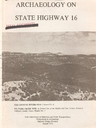
| dc.description.abstract | The Crystal Rivers Site (41 BX 195) was recorded during a survey of State Highway 16 in May 1973. The site consists of an extensive occupation area with its prominent feature being a large, but scattered, burned rock midden. The site is located on the east bank of a western tributary of Government Canyon Creek approximately two miles southeast of the small community of San Geronimo in Bexar County. Due to the extensive accumulation of cultural material within the right-of-way of the proposed widening of State Highway 16, further investigation was recommended.
Thoughout July of 1973, under Antiquities Permit No. 38, the site was excavated by and archaeological crew from the State Department of Highways and Public Transportation.
Although a considerable amount of agricultural disturbance had taken place, extensive amounts of cultural debris remained providing a large lithic sample representative of the area. When the depth of disturbance became apparent, collection of the lithic sample became the primary objective. | en_US |
| dc.language.iso | en_US | en_US |
| dc.publisher | State Department of Highways and Public Transportation | en_US |
| dc.relation.ispartofseries | Publications in Archaeology;No. 6 | |
| dc.subject | Archaeology | en_US |
| dc.subject | Crystal Rivers | en_US |
| dc.subject | Texas | en_US |
| dc.subject | State Highway 16 | en_US |
| dc.title | Archaeology on State Highway 16: The Crystal Rivers Site | en_US |
| dc.type | Book | en_US |
Files in this item
- Name:
- ArchaeologyOnStateHighway_Crys ...
- Size:
- 2.671Mb
- Format:
- PDF
- Description:
- PDF
This item appears in the following Collection(s)
Show simple item record